Flyer & Brochures
The SDI Germany offers a wide range of information material for free download.

|
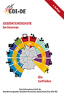
A guideline: GEOSERVICES on the internet |

|
National Geoinformation Strategy (NGIS) |

|
SDI Germany Information Flyer |

|
SDI-Architecture Germany The GDI-DE (SDI) Architecture is based on established national and international norms and standards from overall information technology and the geoinformation domain. |

|
Information flyer of the SDI Germany testsuite Central testing platform for a sustainable quality management.The quality of the Spatial Data Infrastructure Germany (GDI-DE) depends above all on the degree of accessibility of available spatial data. From a technical point of view interoperable provision of the relevant spatial data through the adherence to open standards is the key to this data accessibility. The GDI-DE testsuite supports you in the interoperable provision of your data within the scope of the GDI-DE and beyond.
|

|
Information flyer of the SDI Germany Monitor The SDI Germany Monitor is the latest National Technical Component (NTK) of the Spatial Data Infrastructure Germany (GDI-DE) and offers extensive possibilities for quality monitoring of all metadata in the GDI-DE. The web application is primarily aimed at geodata providers. |

|
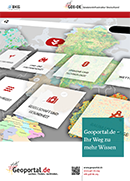
Geoportal.de information flyer Geoportal.de is a service provided by the federal government, state governments and local authorities for the needs of the interested members of the public as well as for experts. It constitutes an active contribution by the administration in Germany for an open knowledge and information society. |

|
Informational flyer on the topic of INSPIRE INSPIRE (Infrastructure for Spatial Information in Europe) stands for Directive 2007/EC of the European Parliament and of the Council establishing an Infrastructure for Spatial Information in the European Community. The Directive entered into force on 15 May 2007 and must be enacted in national law by each of the EC member states within two years. The objective of this Directive is to facilitate and enhance the cross-border use of data within Europe. INSPIRE requires web-based online services for search, visualisation and downloading of the relevant data. |
To receive a printed version of the brochures & flyers, please send an e-mail to: mail@gdi-de.org
Please include your name (first name optional), the name of your institution, your address (street, house number, postcode, city), the name of the brochure(s) and/or flyer(s) and the number of copies.
Please refer to the data protection declaration linked here for information on data protection (german version) before ordering:
